Click to visit the main New York Public Library Homepage
The New York Public Library
Digital Collections
About Digital Collections
Browse
Search only public domain materials
Items
Collections
Divisions
Home
Search
Browse
About
Search only public domain materials
Items
Collections
Divisions
Digital Collections
Using Images
Using Data
Collections
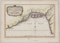
Negroland and Guinea: with the European settlements explaining what belongs to England, Holland, Denmark &c
Negroland and Guinea: with the European settlements explaining what belongs to England, Holland, Denmark &c
About
Filters
Collection Data
Names
Moll, Herman, -1732
(Cartographer)
Bowles, John, 1701-1779
(Author)
Bowles, Thomas, 1694-1773
(Author)
Dates / Origin
Date Issued:
1732
(Questionable)
Place:
London
Publisher:
Printed for Tho. Bowles and John Bowles
Library locations
Schomburg Center for Research in Black Culture, Jean Blackwell Hutson Research and Reference Division
Shelf locator: Sc Map N-128
Genres
Maps
Notes
Statement of responsibility: by H. Moll ...
Content: Imprint derived from the atlas in which the map was issued.
Content: Shows boundaries, rivers and settlements.
Numbering: Numbered 48.
Content: Relief shown pictorially.
Content: London meridian.
Content: West Africa, showing River Niger.
Physical Description
Extent: 1 map, 21 x 28 cm.
Type of Resource
Cartographic
Identifiers
NYPL catalog ID (B-number):
b15591919
Universal Unique Identifier (UUID): 7aec2670-f015-0131-535f-58d385a7b928
Show filters
Hide filters
Show Only Public Domain
name
Bowles, John, 1701-1779
1
Bowles, Thomas, 1694-1773
1
Moll, Herman, -1732
1
collection
x
Negroland and Guinea: with the European settlements explaining what belongs to England, Holland, Denmark &c
genre
Maps
1
publisher
Printed for Tho. Bowles and John Bowles
1
division
Schomburg Jean Blackwell Hutson Research and Reference Division
1
type
cartographic
1
Date Range
to
1 result found
Sort by:
Title
Date created
Date digitized
Sequence
Negroland and Guinea: with th…