


- The Library Shop
- Privacy Policy
- Rules and Regulations
- Using the Internet
- Website Terms and Conditions
- Gifts of Materials to NYPL
-
© The New York Public Library, 2026
The New York Public Library is a 501(c)(3) | EIN 13-1887440
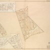
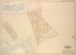
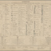
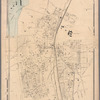
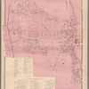
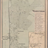
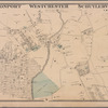
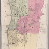
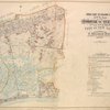
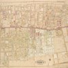
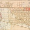
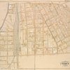
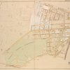
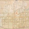
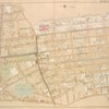
Lionel Pincus and Princess Firyal Map Division, The New York Public Library. "Queens, Vol. 1, Double Page Plate No. 30; Part of Ward 4; Sub Plan From Plate Nos. 18 and 19; [ Map bounded by Farmers Ave., Emerson St., Hawthorn St., 1st St., 2nd St., 3rd St., 4th St., 5th St., 6th St., 7th St.; Including New York Ave., Nottawa St., Woodlawn Ave., Locust Ave.];; Sub Plan From Plate No. 19; [Map bounded by Springfield Road, White St., Cherry Ave., Walbridge St., Grant PL., Douglas PL.; Including Locust Ave., Lenox St., Salem St., Miller St., Dover St., Summit St., Fairview Ave.]" The New York Public Library Digital Collections. 1907. https://old-digitalcollections.nypl.org/items/632461fe-bb60-97e3-e040-e00a18063f5b
Lionel Pincus and Princess Firyal Map Division, The New York Public Library. "Queens, Vol. 1, Double Page Plate No. 30; Part of Ward 4; Sub Plan From Plate Nos. 18 and 19; [ Map bounded by Farmers Ave., Emerson St., Hawthorn St., 1st St., 2nd St., 3rd St., 4th St., 5th St., 6th St., 7th St.; Including New York Ave., Nottawa St., Woodlawn Ave., Locust Ave.];; Sub Plan From Plate No. 19; [Map bounded by Springfield Road, White St., Cherry Ave., Walbridge St., Grant PL., Douglas PL.; Including Locust Ave., Lenox St., Salem St., Miller St., Dover St., Summit St., Fairview Ave.]" New York Public Library Digital Collections. Accessed October 30, 2026. https://old-digitalcollections.nypl.org/items/632461fe-bb60-97e3-e040-e00a18063f5b
Lionel Pincus and Princess Firyal Map Division, The New York Public Library. (1907). Queens, Vol. 1, Double Page Plate No. 30; Part of Ward 4; Sub Plan From Plate Nos. 18 and 19; [ Map bounded by Farmers Ave., Emerson St., Hawthorn St., 1st St., 2nd St., 3rd St., 4th St., 5th St., 6th St., 7th St.; Including New York Ave., Nottawa St., Woodlawn Ave., Locust Ave.];; Sub Plan From Plate No. 19; [Map bounded by Springfield Road, White St., Cherry Ave., Walbridge St., Grant PL., Douglas PL.; Including Locust Ave., Lenox St., Salem St., Miller St., Dover St., Summit St., Fairview Ave.] Retrieved from https://old-digitalcollections.nypl.org/items/632461fe-bb60-97e3-e040-e00a18063f5b
<ref name=NYPL>{{cite web | url=https://old-digitalcollections.nypl.org/items/632461fe-bb60-97e3-e040-e00a18063f5b | title=
(cartographic)
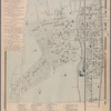
Queens, Vol. 1, Double Page Plate No. 30; Part of Ward 4; Sub Plan From Plate Nos. 18 and 19; [ Map bounded by Farmers Ave., Emerson St., Hawthorn St., 1st St., 2nd St., 3rd St., 4th St., 5th St., 6th St., 7th St.; Including New York Ave., Nottawa St., Woodlawn Ave., Locust Ave.];; Sub Plan From Plate No. 19; [Map bounded by Springfield Road, White St., Cherry Ave., Walbridge St., Grant PL., Douglas PL.; Including Locust Ave., Lenox St., Salem St., Miller St., Dover St., Summit St., Fairview Ave.], (1907)
|author=Digital Collections, The New York Public Library |accessdate=October 30, 2026 |publisher=The New York Public Library, Astor, Lenox, and Tilden Foundations}}</ref>