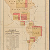
TitleAn improved map of the surveyed part of the territory of Michigan
Additional title: Map of the surveyed part of the territory of Michigan
NamesFarmer, John, 1798-1859 (Creator)Balch, Vistus, 1799-1884 (Engraver)Stiles, Samuel, 1796-1861 (Engraver)Farmer, John, 1798-1859 (Publisher)
CollectionMaps of North America
Countries
United States (except New York)
States
Michigan
Dates / OriginDate Issued: 1831Place: Detroit, Mich.Publisher: John Farmer
Library locationsLionel Pincus and Princess Firyal Map DivisionShelf locator: Map Div. 16-5368
TopicsMichiganMichigan -- Administrative and political divisionsLower Peninsula (Mich.)Mackinac, Straits of (Mich.)Saint Ignace (Mich.)Grant County (Wis.)Green Bay (Wis.)Mackinac Island (Mich.)Huron, Lake (Mich. and Ont.) -- Mackinac, Straits of (Mich.)Wisconsin
GenresMaps
NotesStatement of responsibility: By John Farmer ; V. Balch and S. Stiles, engravers, N.Y.Statement of responsibility: "Entered according to Act of Congress in the Clerk's Office of the Circuit & District court of Detroit in the Territory of Michigan by John Farmer, on the 11th day of May 1829."Citation/reference: Karpinski, Louis Charles. Bibliography of the printed maps of Michigan, no. 106, p. 247
Citation/reference: New York Public Library. Dictionary catalog of the Map Division, v. 6, page 459, column 1, no. 2Funding: Mapping the Nation (NEH grant, 2015-2018)Content: Scale 1:506,880. 8 miles to an inch (W 87°20ʹ--W 82°20ʹ/N 43°50ʹ--N 41°30ʹ).
Physical DescriptionExtent: 1 map : hand colored ; 52 x 87 cm, on sheet 53 x 89 cmNYPL Map Div. copy imperfect: several pieces of map lacking especially along the edges.
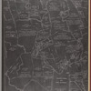
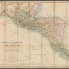
DescriptionMap shows Michigan south of Saginaw Bay divided into counties and sections. Prime meridians: Greenwich and Washington, D.C. Includes text notes relating to War of 1812 and 5 insets: Map of the Straits of Michillimackinac from actual surveys -- Map of Pte. Ste. Ignace -- Map of the most important parts of the lead mine district near the Mississippi River -- Map of the private claims at Green Bay from actual survey -- Map of Michillimackinac Isle. Insets represent isolated areas of territory where there were particular property interests.
Type of ResourceCartographic
IdentifiersRLIN/OCLC: 166638677NYPL catalog ID (B-number): b20645195Folder number: US103.1.04Universal Unique Identifier (UUID): 51e30420-a235-0135-9476-2174587d66ed
Rights StatementThe New York Public Library believes that this item is in the public domain under the laws of the United States, but did not make a determination as to its copyright status under the copyright laws of other countries. This item may not be in the public domain under the laws of other countries. Though not required, if you want to credit us as the source, please use the following statement, "From The New York Public Library," and provide a link back to the item on our Digital Collections site. Doing so helps us track how our collection is used and helps justify freely releasing even more content in the future.
Item timeline of events
-
-
-
-
-
-