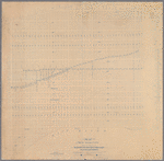
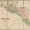





![Central Park : memorial of the Common Council of the City of New York to the Legislature, approved June 11th, 1853...[title page]](https://images.nypl.org/index.php?id=5190254&t=b)


- The Library Shop
- Privacy Policy
- Rules and Regulations
- Using the Internet
- Website Terms and Conditions
- Gifts of Materials to NYPL
-
© The New York Public Library, 2026
The New York Public Library is a 501(c)(3) | EIN 13-1887440
Lionel Pincus and Princess Firyal Map Division, The New York Public Library. "Map of New York City showing location of the consolidated telegraph and electrical subway Co's electric light subways : giving dimensions of manholes and distances between manholes also the side of the street on which the subways are laid / Leonard F. Beckwith, Chief Engineer" The New York Public Library Digital Collections. 1889. https://old-digitalcollections.nypl.org/items/cf913ed0-f3a2-0130-c03d-58d385a7b928
Lionel Pincus and Princess Firyal Map Division, The New York Public Library. "Map of New York City showing location of the consolidated telegraph and electrical subway Co's electric light subways : giving dimensions of manholes and distances between manholes also the side of the street on which the subways are laid / Leonard F. Beckwith, Chief Engineer" New York Public Library Digital Collections. Accessed October 10, 2026. https://old-digitalcollections.nypl.org/items/cf913ed0-f3a2-0130-c03d-58d385a7b928
Lionel Pincus and Princess Firyal Map Division, The New York Public Library. (1889). Map of New York City showing location of the consolidated telegraph and electrical subway Co's electric light subways : giving dimensions of manholes and distances between manholes also the side of the street on which the subways are laid / Leonard F. Beckwith, Chief Engineer Retrieved from https://old-digitalcollections.nypl.org/items/cf913ed0-f3a2-0130-c03d-58d385a7b928
<ref name=NYPL>{{cite web | url=https://old-digitalcollections.nypl.org/items/cf913ed0-f3a2-0130-c03d-58d385a7b928 | title=
(cartographic)
Map of New York City showing location of the consolidated telegraph and electrical subway Co's electric light subways : giving dimensions of manholes and distances between manholes also the side of the street on which the subways are laid / Leonard F. Beckwith, Chief Engineer, (1889)
|author=Digital Collections, The New York Public Library |accessdate=October 10, 2026 |publisher=The New York Public Library, Astor, Lenox, and Tilden Foundations}}</ref>