
+ o - ^
previous next

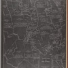
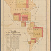
Albemarle and Chesapeake Canal : connecting Chesapeake Bay with Currituck, Albemarle and Pamlico sounds and their tributary streams

More Details Cite This Item

View this item elsewhere:

Title
Albemarle and Chesapeake Canal : connecting Chesapeake Bay with Currituck, Albemarle and Pamlico sounds and their tributary streams
Names
Lathrop, John (Creator)
Albemarle and Chesapeake Canal Company (Publisher)
Hosford & Ketcham (Printer)
Collection

Maps of North America

Countries

United States (except New York)

States

Virginia

Dates / Origin
Date Issued: 1857
Place: Norfolk, Va.?
Publisher: Albemarle and Chesapeake Canal Company
Library locations
Lionel Pincus and Princess Firyal Map Division
Shelf locator: Map Div. 17-5459
Topics
Canals -- Virginia
Canals -- North Carolina
Canals
Albemarle and Chesapeake Canal (Va. and N.C.)
North Carolina
United States -- Albemarle and Chesapeake Canal (Va. and N.C.)
Virginia
Genres
Maps
Notes
Funding: Mapping the Nation (NEH grant, 2015-2018)
Physical Description
Extent: 1 map ; 75 x 57 cm, on sheet 81 x 65 cm
Description
Also shows counties, cities, towns, railroads and proposed railroads, selected landowners, and notable physical features. With "explanations" in lower right corner. By John Lathrop, civil engineer.
Type of Resource
Cartographic
Identifiers
RLIN/OCLC: 1000612529
NYPL catalog ID (B-number): b20646497
Folder number: US248.1.01
Universal Unique Identifier (UUID): 54619280-667c-0135-e2f3-019ebdb98b9f
Rights Statement
The New York Public Library believes that this item is in the public domain under the laws of the United States, but did not make a determination as to its copyright status under the copyright laws of other countries. This item may not be in the public domain under the laws of other countries. Though not required, if you want to credit us as the source, please use the following statement, "From The New York Public Library," and provide a link back to the item on our Digital Collections site. Doing so helps us track how our collection is used and helps justify freely releasing even more content in the future.

Item timeline of events

  • 1857: Issued
  • 2017: Digitized
  • 2026: Found by you!
  • 2027

MLA Format

Lionel Pincus and Princess Firyal Map Division, The New York Public Library. "Albemarle and Chesapeake Canal " The New York Public Library Digital Collections. 1857. https://old-digitalcollections.nypl.org/items/ec9af6e0-875e-0135-e6de-0d57f875f93a

Chicago/Turabian Format

Lionel Pincus and Princess Firyal Map Division, The New York Public Library. "Albemarle and Chesapeake Canal " New York Public Library Digital Collections. Accessed October 6, 2026. https://old-digitalcollections.nypl.org/items/ec9af6e0-875e-0135-e6de-0d57f875f93a

APA Format

Lionel Pincus and Princess Firyal Map Division, The New York Public Library. (1857). Albemarle and Chesapeake Canal Retrieved from https://old-digitalcollections.nypl.org/items/ec9af6e0-875e-0135-e6de-0d57f875f93a

Wikipedia Citation

<ref name=NYPL>{{cite web | url=https://old-digitalcollections.nypl.org/items/ec9af6e0-875e-0135-e6de-0d57f875f93a | title= (cartographic) Albemarle and Chesapeake Canal , (1857) |author=Digital Collections, The New York Public Library |accessdate=October 6, 2026 |publisher=The New York Public Library, Astor, Lenox, and Tilden Foundations}}</ref>

Albemarle and Chesapeake Canal