Click to visit the main New York Public Library Homepage
The New York Public Library
Digital Collections
About Digital Collections
Browse
Search only public domain materials
Items
Collections
Divisions
Home
Search
Browse
About
Search only public domain materials
Items
Collections
Divisions
Digital Collections
Using Images
Using Data
Search
Filtered search
Show filters
Hide filters
Show Only Public Domain
topic
Administrative and political divisions
161
Railroads
151
Landowners
91
Real property
83
History
72
More
Less
name
Burr, David H., 1803-1875
63
Tanner, Henry Schenck, 1786-1858
29
Rawdon, Clark & Co
25
Rawdon, Wright & Co
25
Mitchell, S. Augustus (Samuel Augustus), 1792-1868
23
More
Less
collection
Maps of North America
516
Maps of New York City and State
236
Atlases of the United States
48
Lawrence H. Slaughter Collection of English maps, charts, globes, books and atlases
34
Series of advertising cards issued by Arbuckle Bros. Coffee Company, each consisting of a map of a country of the world with related illustrations
5
More
Less
place
New York (State)
242
United States
156
New York (N.Y.)
87
Massachusetts
60
New Jersey
49
More
Less
genre
Maps
865
Cadastral maps
54
Atlases
44
Tourist maps
7
Facsimiles
6
More
Less
publisher
publisher not identified
64
For sale by the principal booksellers
20
s.n
15
s.n.,
15
J.H. Colton
11
More
Less
division
Map Division
854
Schomburg Jean Blackwell Hutson Research and Reference Division
11
Rare Book Division
1
Wallach Division: Picture Collection
1
type
cartographic
865
still image
12
text
7
Date Range
to
867 results found
Filtering on:
x
Note
: Relief shown by hachures.
Sort by:
Title
Date created
Date digitized
Sequence
Results 251 - 300
Map of a section of the Cobbe…
A New map of Maine
m
Piscataqua Harbour, Portsmout…
m
Map Of The State Of Maine
m
A topographical map of Lincol…
Historical map of Sanbornton
Mount Desert [Island] via Bos…
Map of the seat of war to acc…
Extract from a map entitled P…
Plan of Boston: corrected und…
Map of Boston: from the lates…
Map of Boston: from the lates…
Map of Westchester County, N.…
Map of Steuben County: to acc…
Map of Rockland Co: [New York]
Map of Orleans County, New Yo…
Plan of Orange County, New Yo…
Map of Orange County: [New Yo…
Road map of Westchester Co., …
m
The Matthews-Northrup up-to-d…
Map of the United States of A…
A map of the country between …
Telegraph and rail road map o…
m
Schonberg's imperial map of t…
m
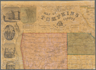
Map of Tompkins County, New Y…
m
Map of Maine, New Hampshire, …
Smith's rail road, steam boat…
m
Watson's new county and railr…
m
Map of the United States and …
Map of part of Orange County,…
m
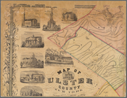
Map of Ulster County, New York
Map of Chenango County, New Y…
m
Map of the states of Kansas a…
Map of the town of Roxbury
Rapid Transit Commission, pla…
Map of the Town of Milford, M…
m
Map of northern parts of the …
Isogonic chart of the United …
Map showing the route of the …
A geological map of a part of…
Centennial map of Concord, 17…
Map of the city of Lynn, Mass…
Historical map of Nantucket
Map of Lynn, Mass: (Diphtheri…
m
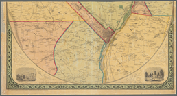
Map of the vicinity of Albany…
m
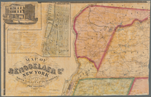
Map of Rensselaer Co., New Yo…
m
Map of Delaware Co., New York
m
Map of Orange and Rockland Co…
m
National map of the territory…
Map of the county of Plymouth…
1
2
3
4
Previous
Next
1
2
3
4
Previous
Next