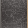
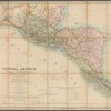
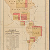
TitleMap of the States of Michigan and Wisconsin : embracing a great part of Iowa, Illinois & Minnesota, and the whole mineral region, with charts of the lakes : exhibiting the sections, the soundings, the geological formations & the general topography
NamesFarmer, John, 1798-1859 (Creator)R. Farmer & Co. (Publisher)Farmer, John, 1798-1859 (Engraver)
CollectionMaps of North America
Countries
United States (except New York)
Parts
Dates / OriginDate Issued: 1861Place: Detroit, MichiganPublisher: Published by R. Farmer & Co.
Library locationsLionel Pincus and Princess Firyal Map DivisionShelf locator: Map Div. 16-5391
TopicsGeology -- MinnesotaGeology -- WisconsinMichiganWisconsinMinnesotaIsle Royale (Mich.)Beaver Islands (Mich.)Sault Sainte Marie Canal (Mich.)Detroit River (Mich. and Ont.)Port Collier (Mich.)Mackinac, Straits of (Mich.)
GenresMapsGeological maps
NotesStatement of responsibility: Projected & engraved by John Farmer, c.e, Detroit, Michigan.Statement of responsibility: "Entered according to act of Congress ... 29th day of Sept., A.D. 1858 by John Farmer ... And reentered as above this 21st day of Jany A.D. 1861 by R. Farmer & Co., as publishers and proprietors."Citation/reference: Barnett, L. Michigan maps, 5-2054 ; Karpinski, Louis Charles. Bibliography of the printed maps of Michigan, 239Q ; New York Public Library. Dictionary catalog of the Map Division, v. 6, page 460, column 3, no. 2Funding: Mapping the Nation (NEH grant, 2015-2018)Content: Scale 1:1,475,200. 7 1/2 miles to an inch (W 94°15ʹ--W 82°20ʹ/N 48°20ʹ--N 41°30ʹ).
Physical DescriptionExtent: 1 map : hand colored ; 162 x 181 cm, on sheet 170 x 188 cm ; NYPL Map Div. copy divided into 2 sheets 170 x 94 cm
DescriptionRelief shown by hachures and spot heights; depths shown by soundings. Includes Michigan census table and "Geological references for Wisconsin, Iowa and Minnesota." Insets: Geological map of Isle Royale, Lake Superior -- Map of Beaver Isles -- Map and a profile of the canal at Sault Ste. Mary -- Geological map of portions of Minnesota and Wisconsin designed to show portions of the rock formations now concealed by drift -- Map of the surveyed part of Minnesota lying east of Mississippi River -- Chart of Detroit River -- Chart of Port Colier -- Connection of the private claims with the public surveys at Pte. Ste. Ignace. "Compiled from the Topographical Departments, from the office of the United States Lake Surveys, from the latest geological and linear surveys, and from various other authentic and reliable sources."
Type of ResourceCartographic
IdentifiersRLIN/OCLC: 58531264NYPL catalog ID (B-number): b20645218Folder number: US104.2.01Universal Unique Identifier (UUID): 9aaf1e10-a07e-0135-a5b5-09d6386fa565
Rights StatementThe New York Public Library believes that this item is in the public domain under the laws of the United States, but did not make a determination as to its copyright status under the copyright laws of other countries. This item may not be in the public domain under the laws of other countries. Though not required, if you want to credit us as the source, please use the following statement, "From The New York Public Library," and provide a link back to the item on our Digital Collections site. Doing so helps us track how our collection is used and helps justify freely releasing even more content in the future.
Item timeline of events
-
-
-
-
-
-